Here’s a riddle for you: I have two passports, but I do not have dual citizenship, and I’m not a secret agent.
Can you figure it out? Give up?
Well, one of my passports gets me in and out of the country, while my other passport is for the national parks!
Our national parks are an absolute treasure. They preserve an incredible diversity of landscapes, ecosystems, and history; I’m continually amazed by the uniqueness of the parks I visit. Currently there are 63 national parks, but they continue to add new ones to the list over time. Like in December 2020, when West Virginia’s New River Gorge was upgraded from “national river” to “national park.” So far I’ve been to 21 of the parks, which means I still have a pleasantly long way to go to reach my goal of someday visiting all of them.
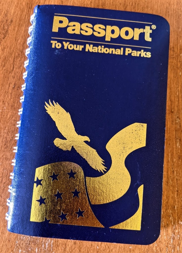
In addition to the photos, t-shirts, and coffee mugs I’ve accumulated as souvenirs of my parks adventures, I also have a collection of “passport” stamps. The National Park Service created a passport book that visitors can use to document their travels.
It divides the country into nine geographical regions; each section of the book features a map and list of the national sites within that region, a bit of background information on the region, and a set of blank pages to use for stickers and cancellation stamps.
Getting your passport stamped is such a fun way to anchor and commemorate a visit to a new park.
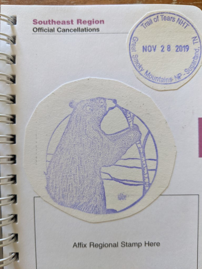
So how’s it work? Every park has a station, typically in the visitor’s center, housing an inkpad and a cancellation stamp featuring the location and current date. Sometimes there is a bonus stamp, maybe a black bear if you are in the Great Smoky Mountains . . .
Bonus stamp!
. . . or a bathhouse if you are visiting Hot Springs.
Turn to the correct section of your book, stamp the page, and voilà. (And if you ever forget to bring your book with you, just stamp on a loose scrap of paper and add it to your book later.)
It is not only at national parks, though, where you can stamp your passport. There are more than 400 areas managed by the National Park Service, from national historical sites and battlefields, to national monuments and memorials, to national forests and lakeshores. . . . If it has the word “National” in front of it, there is a passport stamp to be had.
And sometimes, you have to be tenacious and creative if you want your cancellation stamp.
In June 2021, I visited Yosemite National Park with my husband, sister, and niece. Yosemite is huge and has several distinct regions within it, featuring giant sequoias, tumbling waterfalls, pristine alpine lakes. Not to mention the iconic edifices of El Capitán and Half Dome, of course.
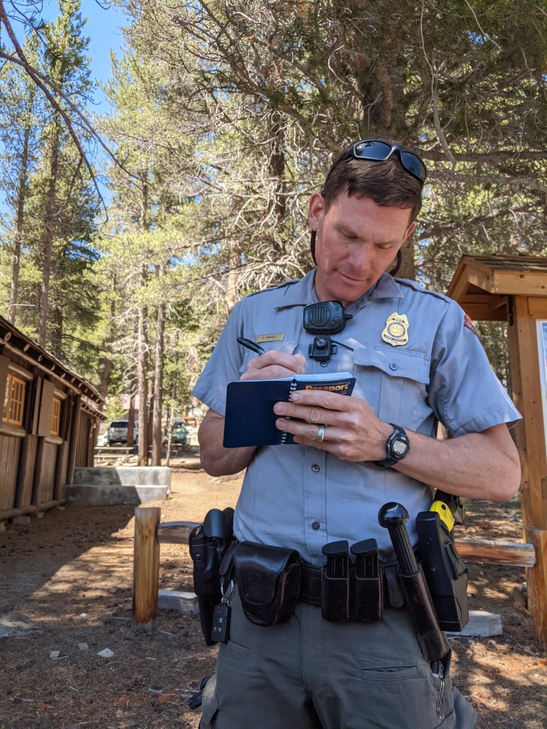
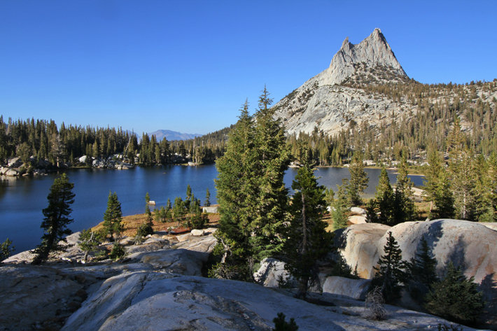
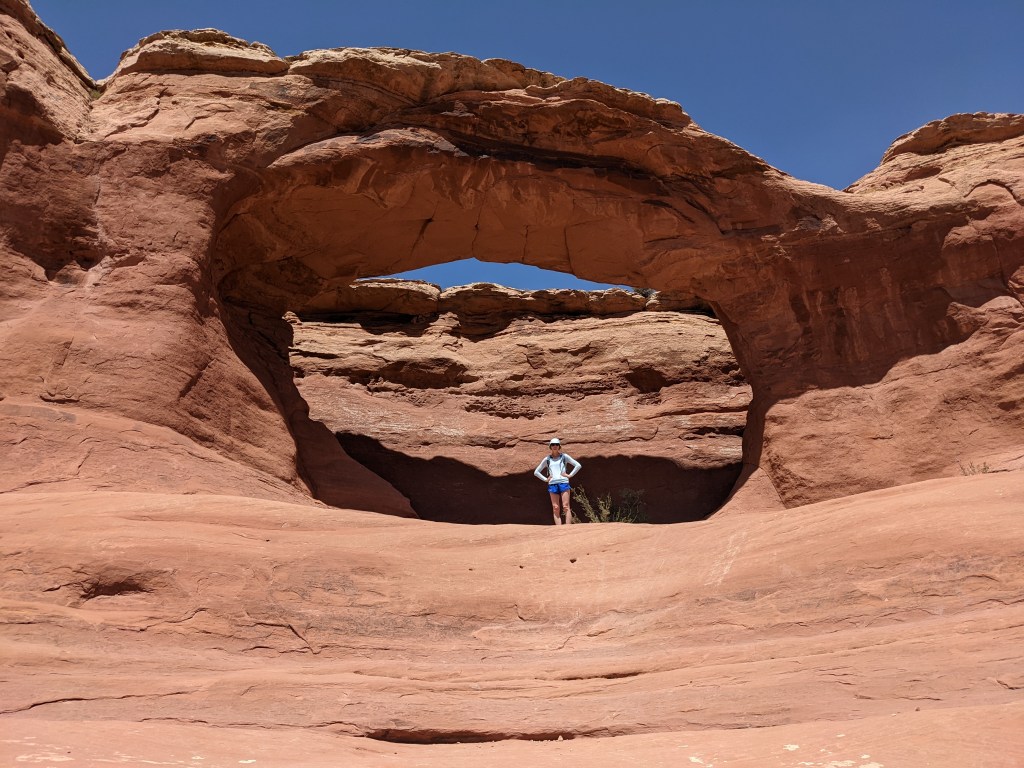
There are three visitor’s centers—at Wawona, Yosemite Valley, and Tuolumne Meadows—and each has its own cancellation stamp. Obviously, we wanted to stamp our passports at all of them. The trouble came when we drove out to Tuolumne Meadows. (By the way, it is pronounced “too-ALL-uh-me.” I had to google that.) It is a long drive to the meadows from Yosemite Valley, but it is breathtaking. Meandering creeks, granite domes, asters and sedge and pines. During summer 2021 the pandemic was still going strong, and that meant that throughout Yosemite, some park amenities remained closed. We hiked around and explored Tuolumne, but when it came time to stop by the visitor’s center before our drive back, it was closed, and there was no sign of an outdoor stamping station.
Not cool. We had driven through the park for TWO HOURS, yes to explore the beautiful sub-alpine lakes and meadows, but also . . . to get a stamp. As we trolled around looking for a makeshift stamping station, we spotted a park ranger. We flagged him down and asked, with the merest hint of desperation, if he knew where to find the passport stamp. He did not. But when my sister asked him if HE would draw a stamp in our passport books for us, he didn’t hesitate. He whipped out a pen and cheerfully obliged. It is easily my favorite stamp so far.
It’s Cathedral Peak!
Cathedral Peak (Source: yosemitehikes.com)
The passport books are a bit of a rabbit hole. There are sheets of stickers you can purchase, a different collection each year, which highlight various sites in each of the geographical regions. These are neat, but I wish I could purchase the regional stickers a-la-carte, because I wind up with a lot of stickers I don’t need. These days I mostly just stick with the cancellation stamps.
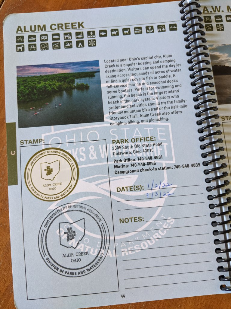
I already had my work cut out for me with the national parks passport book. But then for Christmas, my sister got me a passport book for Ohio’s 75 state parks. I didn’t know such a thing existed!
This passport book includes a set of stickers that you can use to document each park as you visit it, in case you are not able to find the official stamp while you are there. Alum Creek is the park closest to where I live and where I earned my first official stamp.
So I guess that means I have not just two, but three, passports. I’d better pack my bags—I’ve got some traveling to do!
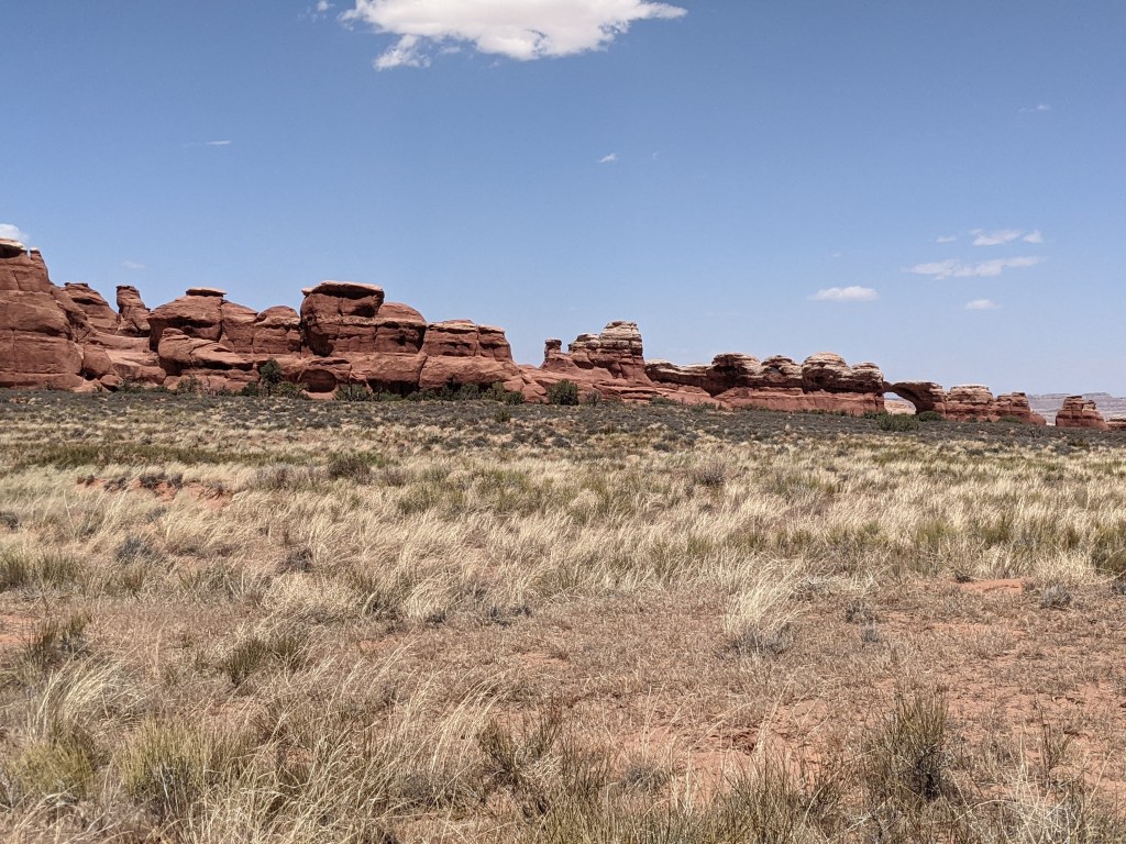
There are five national parks in Utah (the so-called “Mighty 5”): Arches, Bryce Canyon, Canyonlands, Capitol Reef, and Zion.
Utah’s Mighty 5 (Source: utah.com)
A few years ago my husband and I visited Zion and Bryce; this summer we traveled to Arches and Canyonlands.
Of the four Utah parks we’ve explored, there are some notable similarities.
They are hot. They are colorful. They are rocky. They are majestic.
Yet each has something unique that distinguishes it from the others.
Arches reveals its claim to fame right there in its name. It is a high-desert marvel of red rock cliffs, fins, buttes, monoliths, spires, and, well, more than 2,000 arches. One of the fun things about the park is discovering doppelgangers in the rock formations. Many of the rocks resemble others things; it’s kind of like seeing shapes in the clouds.
Some of the formations already have names, like:
Elephant Butte…
Elephant Butte
and Three Gossips.
Three Gossips
Can you tell what the next one is? It’s a little tougher. Scroll down to the bottom for the answer.
?
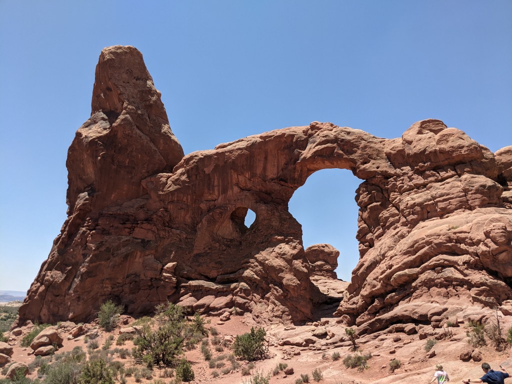
Many of the arches have names as well, like Double Arch and Turret Arch.
Double Arch is the tallest at the park, and very popular for scrambling and photo ops.Turret Arch
In general the names are appropriately descriptive, sometimes amusing or whimsical. There are a few arches, however, that didn’t seem to correspond to their names at all! Read on to find out more about three distinct Arches experiences, featuring plenty of marvels and a few misnomers.
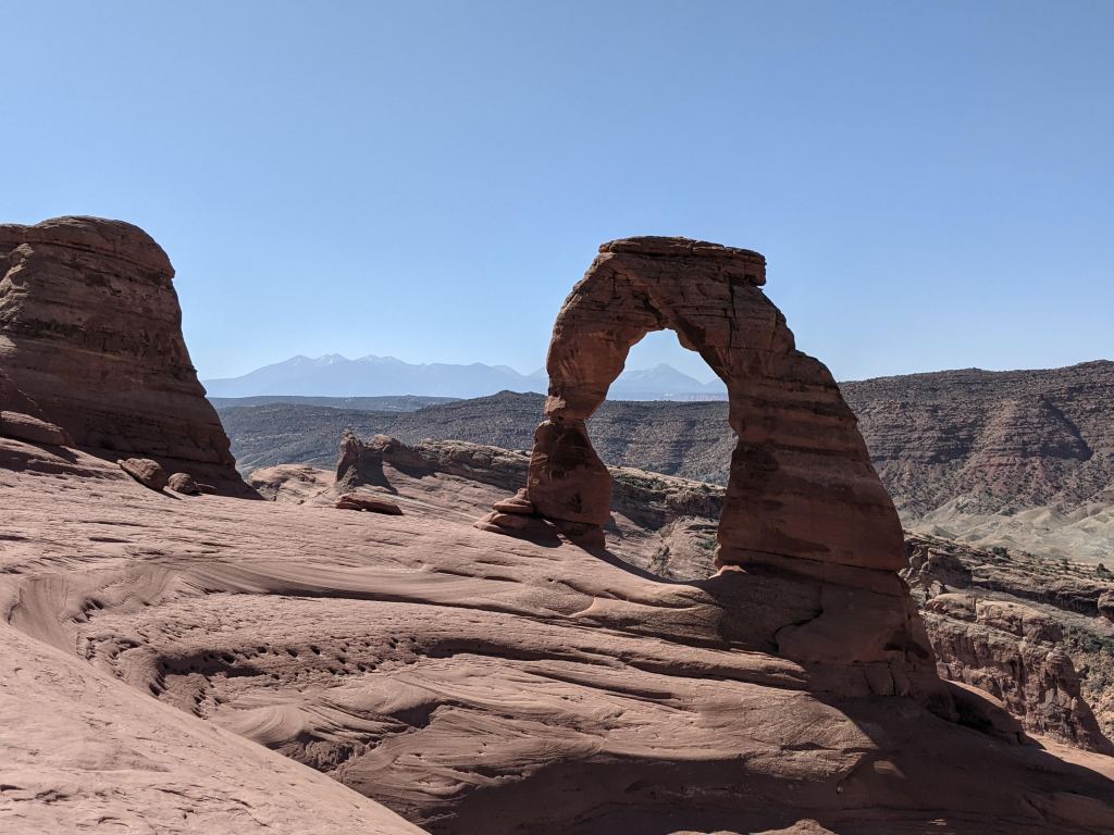
Delicate Arch
Delicate Arch is probably the most iconic sight at Arches. It is showcased on the Utah license plate, after all!
Delicate Arch
(Source: dmv.utah.gov)
There are two ways to experience the arch. One is by accessing the Upper or Lower Viewpoint trails, which are short and easy, with the tradeoff that you get only a very distant view of the arch. The other option is to hike the three-mile Delicate Arch trail, a moderately difficult trek up exposed slickrock hills and narrow windswept ledges.
The reward at the end of this trail is fantastic views of the arch, with the tradeoff that you will get buffeted by 30 mph gusts of wind. It is intense. At the top, children burrowed into their parents’ chests, trying to avoid the sand blasting their faces. The rest of us staggered around trying not to get blown off the cliff as we posed for pictures.
So windy!
I’m not sure how this arch got named “delicate,” because to me it seemed anything but. I guess it is a bit more slender than some of the arches, and it is perched rather delicately at the top of the bluff, but to withstand the relentless wind up there? Whew. Pretty stout.
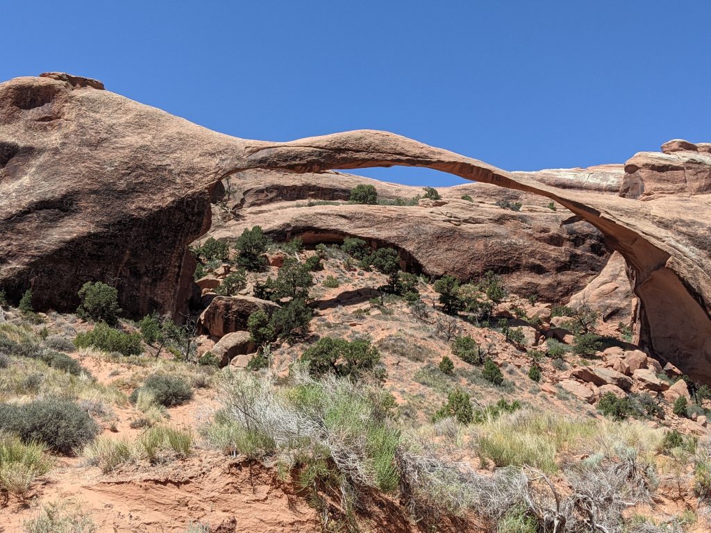
Landscape Arch
Perhaps they’d had a little too much sun on the day they were naming arches, because Landscape Arch is actually much more delicate and graceful than Delicate Arch. Spanning almost 300 feet, this ribbon of rock is the longest natural stone arch in the United States and one of the longest in the world.
Landscape Arch
It wasn’t always quite so slender though. In the 1990s several slabs and chunks of rock broke off and fell from the arch, reducing its girth and necessitating closure of the trail passing underneath it. Landscape Arch is one of many in the Devils Garden section of the park, and you can enjoy its beauty by hiking a relatively easy one-mile (each way) trail. Short spurs nearby lead to a few other arches, like Pine Tree Arch. Which, aptly enough, features a tiny pine tree beneath it.
If we someday return to Arches, I would like to explore the Devils Garden area more thoroughly. There are about eight miles of trails, with rocks and fins to scramble on and hidden arches to discover. With temperatures hovering around 100 degrees on the days we were there, it was simply too hot to hike around all of it.
Tapestry Arch
I have a theory about the trails at national parks. I think that every park has one trail that the rangers agree to downplay and keep quiet, allowing for adventurous hikers to discover and delight in its unexpected solitude and beauty. That trail at Arches is—should I reveal it?? I must. It’s the Sand Dune Arch-Broken Arch-Tapestry Arch trail. And I’m not going to complain about these arch names. Sand Dune and Broken are pretty spot-on. “Tapestry” is kind of bland and uninspiring, but that’s how we’ll keep too many people from finding it, see? We’ll deploy the ol’ Iceland / Greenland naming strategy.
Here’s how our hike unfolded. By the end of our second day at Arches, we were pretty depleted by the cumulative effects of the heat, wind, and elevation. Feeling like our work at Arches was complete, we began driving out of the park. But then we noticed the turnout for Sand Dune Arch, which is billed as a short easy hike. Why not stop and see one last arch before leaving?
We walked the sandy 0.3 mile trail to Sand Dune Arch.
Sand Dune Arch
Then we noticed that across the meadow (just another mile) Broken Arch beckoned. Well, since it was right there, we walked over.
Broken Arch (See it? Over on the right?)
Once we arrived, there was signage that encouraged hikers to climb through the arch to continue on the trail. We figured we should climb up just to take a look . . . but then we kept walking. I mean, at this point it was just a little farther to the third arch, Tapestry Arch.
This was where the trail really turned magical. How was it possible that in a park with hundreds of visitors, we had this trail all to ourselves? We didn’t encounter another soul (except for some lizards) as we followed the carefully-situated cairns to Tapestry Arch. Without the cairns we would have gotten hopelessly lost as we scrambled up and down and over and through the rocks and hills. When we got to the arch we clambered up into its cool recess to sit and marvel at the landscape and the quiet.
Tapestry Arch
It turned out to be the perfect hike to cap off our visit to Arches. It was an unexpected adventure, but often those are the best ones.
I know we’ve got another visit to Utah somewhere in our future, because Capitol Reef is still on the must-see list of parks. When we go, I’d love to stop at Arches again and discover even more of its hidden gems.
Two things to know before you go:
1. Like several other national parks, Arches is piloting a timed entry system during peak months of the year. You must have a reservation to enter the park. They say that the goal is not to reduce the number of visitors, but rather to spread them out more evenly throughout the day, to reduce congestion at the entrance station, in parking lots, and on the trails. Be sure to check the website several months in advance of your visit to make sure that you get your pass, if necessary!
2. Download the National Park Service app. It’s incredible. You’ll find alerts, maps, things to see/do, locations of passport stamps. And one of my favorite parts—a fun little feature that allows you to create virtual “postcards” to send to friends and family.
I was maybe eight years old when I first read Scott O’Dell’s Island of the Blue Dolphins. It’s a captivating story about a teenage girl who survives alone on an island for nearly two decades. She has no choice but to become entirely self-sufficient, building her own shelter, hunting her own food, fashioning her own clothing, her only companion a wild dog she manages to tame. Part of the allure for me was that it was a survival story about a girl. Most books like this tend to feature boys (Gary Paulsen’s novels, like Hatchet and The River, come to mind), so O’Dell’s story was invigorating and inspiring. Possibilities swirled through my suburban brain. Could I coax a squirrel to eat out of my hand? Could I collect enough bird feathers in our yard to make a dress like Karana’s?
The most amazing part is that O’Dell’s book is based on a true story. Though there are many more questions than answers about the mysterious Native American woman, we do know that she lived alone on the island of San Nicolas—a windswept and remote member of California’s eight Channel Islands.
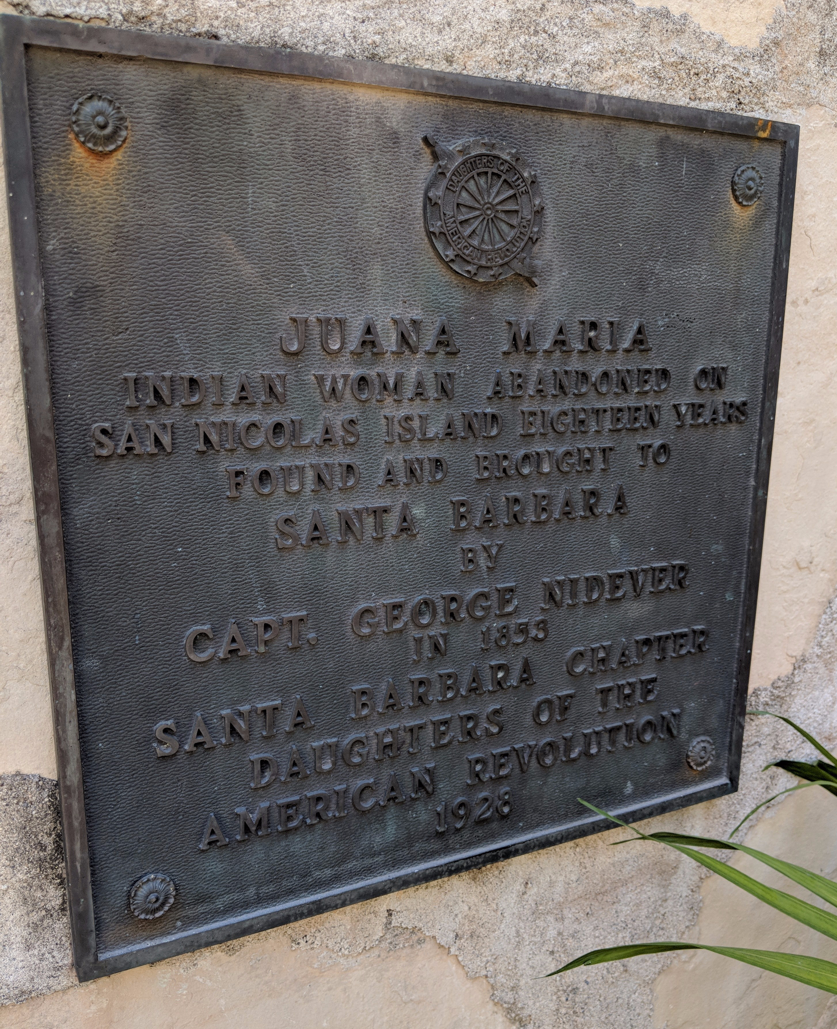
Few facts about her can be verified for certain, but it is believed that she belonged to the Nicoleño people living on the island. However, when the last remaining members of her tribe—most of whom had already been killed in conflicts with seal hunters—were rounded up and shuttled to the mainland in 1835 by the Franciscan friars eager for cheap labor and Christian converts, she was left behind. Several accounts say that she was searching for her son, who was missing from the boat. Subsequent ships sent to the island to search for her were unsuccessful. The story of the “Lone Woman of San Nicolas” became something of a legend on the mainland. But 18 years later, in 1853, Captain George Nidever, a local sailor and hunter, decided to try his hand at finding her. On his third attempt, he located and followed a trail of footprints on the island that led him to the lost woman. She welcomed the captain and his men as guests, and they spent a couple of weeks on the island with the woman, hunting and learning about her way of life as best they could through the language of signs and gestures.
Photo of the woman believed to be Juana Maria (Source)
When they returned to the mainland she came with them (willingly) and was taken to the mission at Santa Barbara. At this point you might be thinking, “Aw, a happy ending!” Well … not so fast.
First, nobody there could communicate with her. She spoke a language unrecognizable to them or to the native peoples residing at other nearby missions. The missionaries christened her “Juana Maria,” and she reputedly was cheerful and good-natured, seeming to be happy in her new home. Secondly, as was the fate for so many natives, she died of disease just weeks after her arrival at the mission.
Figures. After surviving on her own for 18 years on a deserted island! A small plaque honoring Juana Maria adorns the wall of a courtyard at the mission today.
So last summer, an interesting trip came about: My husband and I, along with my parents, met up with my sister and her family in San Diego. We then road-tripped up to Santa Barbara to see the mission, and … to visit Channel Islands National Park, and thus check off one more location on my bucket-list quest to explore all of the U.S. National Parks.
Of the eight islands in the group, only five are part of the park system and open to visitors—the island of San Nicolas is not one of them. So although I couldn’t see the island where “Juana Maria” actually lived, I got about as close as possible and used my imagination to complete the picture.
Channel Islands National Park is one of the lesser-visited in the park system, and it is not hard to see why. It takes a bit of effort to get there. It’s not the kind of place where you easily pop in for a day hike, or book a relaxing weekend at the lodge (there isn’t one). There’s no comfy “driving tour” with convenient pull-offs for your photo ops. If I say “Pacific island” and you picture Tahiti, well, might need to recalibrate your expectations. However, for those intrepid explorers willing and able to go for it, a visit to the islands is an adventure you won’t soon forget. Its remoteness and ruggedness are part of what makes the place so spectacular. So channel your inner Juana Maria and prepare for some memorable experiences!
1. The Ferry Ride
The island we visited, Santa Cruz, is the largest and nearest to the mainland, but even so it requires an hour-long ferry ride to get there. I’ve been on ferries a couple of times, but never a ride as long or, frankly, as rough as this one! It wasn’t exactly a sight-seeing pleasure cruise … though we did see some delightful sights, like sea lions clustered on a buoy enjoying the sun, and dolphins bouncing along outside of our wake. And after an hour at sea, with no land in sight, it gave me chills when our island finally emerged out of the haze, remote and mysterious. I couldn’t stop thinking about Juana Maria, her solitary existence on an island like this one…. Did she walk along the cliffs, gazing out toward the horizon, waiting for a ship to appear?
My eagerness to arrive at the island was twofold. Because as we zipped across the water, bumping over the waves, my fellow passengers began to lose the battle with seasickness. One after another they staggered to the rails, their retching masked for the most part (thankfully) by the wind and waves. It made me start to feel queasy, but I couldn’t tell if I was actually starting to feel a little seasick or if it was just the power of suggestion. Nobody in my party succumbed, perhaps because by chance, we’d chosen seats in the part of the boat that was the calmest. A stroke of luck! Or was it?… (Guess where all the seasick passengers were instructed to convalesce?) Let’s just say I was good and ready to disembark by the time we reached the island. As a little extra insurance, we made sure to stop by the island canteen to pick up some dramamine tablets to pop before the return trip.
(Hmm. Maybe I shouldn’t have led with that story…. Don’t let it deter you from visiting the islands! Really, it’s worth the trip. I promise. Just take some dramamine. And maybe ride in the open cabin on the top of the boat. That’s what we did on the return trip, and the fresh air was fantastic.)
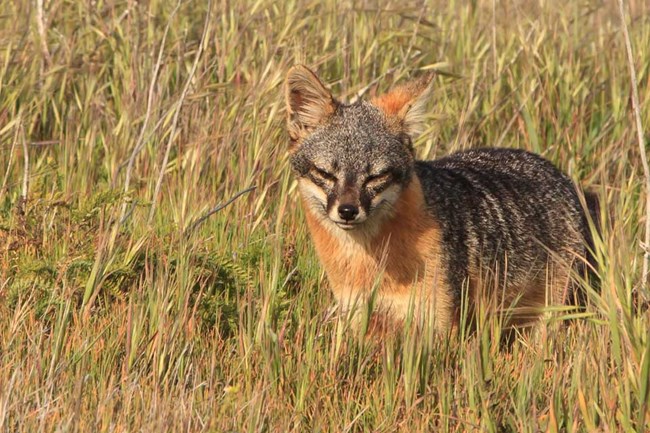
One inhabitant of Santa Cruz is the island fox, and these critters are bold! Reading about them in our guidebook before our visit, we crooned, “Oh, I hope we get to see one of them!” In fact, it would have been hard not to see one. Unlike its nocturnal mainland brethren the gray fox, the island fox has no natural predators and therefore is active at all times of day … especially during visitors’ lunchtime picnics. They were practically tame, sidling up to our tables, trying to elbow their way in for a bite of sandwich.
“Mmm, what’s for lunch?”
Sort of like the Galápagos tortoise or Madagascar’s ring-tailed lemur, the island fox lives only on the Channel Islands. In addition, the subspecies on each island is actually unique—so the island foxes we met on Santa Cruz are not exactly like the foxes on any of the other islands. They are adorable creatures and have the most expressive and inquisitive little faces. Just be prepared—they are persistent to a fault … and in addition to being about the size of the typical housecat, they are similarly disinclined to following orders from humans.
3. Surf or Turf
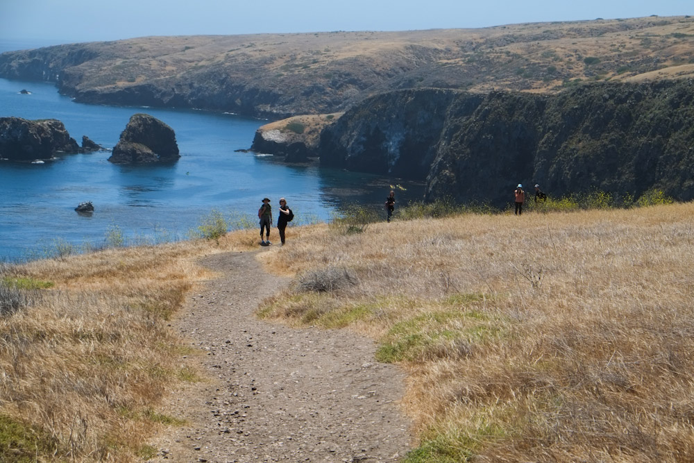
Visitors to Santa Cruz can explore the natural wonders by land or sea. Hiking trails of varying difficulty circle and bisect the island, and there is a kayak and snorkel outfitter from the Scorpion Anchorage area. As we were day visitors to the island (some people stay and camp), we had a limited amount of time to explore and decided to focus on hiking. We hiked the Cavern Point Loop Trail and a portion of Smuggler’s Road, peaceful forays that cut through fields of wildflowers and hugged the clifftops, offering expansive vistas of the bright blue sea.
Being a Mediterranean-type climate, there aren’t many shady trails, but the constant ocean breeze combined with the sun to make our hikes quite comfortable.
Given more time on Santa Cruz, visitors should definitely explore it by sea as well. Guided kayaking trips navigate the sea caves around the shoreline, affording a unique perspective on the island’s flora and fauna. There is even more to see below the surface, if you can brave the chilly Pacific waters. Snorkelers and scuba divers can explore the magical kelp forests in the crystal clear water, which we looked down into from the cliffs high above.
At its warmest, in September, the water is only around 60 degrees! We did at least wade out into the ocean, carefully picking our way across the rocky, pebbled beach. It was frigid. Being fully submerged in the water to dive would certainly be … invigorating!
And since we hadn’t packed our Gillyweed…. Aquatic exploration will have to wait for the next visit.
Harry Potter in the Triwizard Tournament, anyone?? (Source)
All in all, our California adventures were an unforgettable combination of fact and fiction, sea and sand. I’m not sure I could survive alone for 18 years on a deserted island, but next time, maybe I’ll at least give the overnight camping a try.
For Further Exploration
The National Park Service has a section about the Lone Woman of San Nicolas, featuring connections to O’Dell’s novel, information about the history and culture of the native peoples, and updates about archaeological discoveries on the islands.